


Improving food security and enhancing economic development in developing countries requires a multifaceted approach—and that includes access to reliable data. In the swiftly changing Middle East and North Africa (MENA) region, up-to-date information is particularly crucial for policymakers to make accurate assessments of poverty, food and nutrition security, and other development indicators.
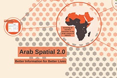
In early 2013, the IFPRI-led open-access database and mapping tool—Arab Spatial—was launched to support this objective. The first initiative of its kind in the MENA region, Arab Spatial compiles, synthesizes, and geographically displays data on more than 200 indicators of food security and development. It analyzes food availability, accessibility, stability, and utilization, and the resulting nutritional status of individuals. It also considers the role that crises like violent conflict and shocks like climate change play in disrupting food security, and, in contrast, the role that policies and interventions can play in improving it.
The database allows users to customize outputs according to their needs. For example, if someone wants to determine a link between droughts and violent conflict, Arab Spatial can map only those indicators or selectively add more layers, depending on the question raised.
Now, one year later, an upgraded version is available. Announced on January 16 at a workshop on “Enhancing resilience to conflict in Arab countries through research and Arab Spatial 2.0,” the latest version includes the following new features:
- a gallery of downloadable pre-made graphs on Arab nations’ development and food security;
- customized analytical tools that allow users to compare and explore data by indicators, regions, and year, and to download the results;
- multilayer maps that dynamically track development projects geographically; and
- simpler navigation and greater interactivity for an enhanced user experience.
The Arab Awakening underscored a desire not only for information, but also a desire for the public to have a say in policy matters. Arab Spatial responds to that need and should be of interest to anyone concerned with food security and economic development in Arab countries. It is designed to help stimulate public debate, policy dialogue, and better decisionmaking with the objective of achieving better lives for everyone, especially the most vulnerable.